Eiger, Muench, and Jungfrau tower over the little mountain town of Wengen, Switzerland. Three of the world’s largest mountains rise nearly 12,000 feet above sea level and 9,000 feet above Wengen. The Eiger is a sheer slab of rock with an almost vertical north face, the Muench, more rounded, and the Jungfrau, covered in snow even in summer.
Working in Wengen one summer during college, I walked in their shadows every day, enthralled with their changing mood. On rainy days they were dark and shrouded in mist and visible only as bulky shapes. On other mornings they were bathed in sunlight and the snow glistened so much that it was blinding. Then in the evenings, as the sun set, the light turned to what in German is called Alpenrose, and the snow turned from a delicate pink to a purple deep as night. In the moonlight they were a dark blue, sharp against the sky and stars above them.
I’ve always wanted to see the peaks up close. But the terrain is notoriously shifty, dangerous, and mysterious.
In the local church I attended while working there, I met an avid mountaineer who tackled these massive peaks during his vacations, piquing my interest in the history of how, in the late 1700s and early 1800s, wealthy and intrepid men and women started the sport of mountain climbing.
They wore ordinary outdoor wear and leather boots—perhaps with steel plates to help grip the rock. The women climbed in divided skirts so as to show no glimpse of leg! Since they were visitors, they employed local farmers or woodsmen as guides, but even they had never ventured above the snow line.
In earlier periods of history, when these high Alpine regions were not easily accessible from the rest of Europe, they were seen as places of mystery and often dark forces. The local farmers in the valleys welcomed the shelter from the winds, but also knew how swiftly snow could descend on the high alpine meadows. It is easy to understand how folk tales developed about the mountains and their names: Eiger, the ogre with its massive bulk, and Muench, the Monk, there to protect Jungfrau, the virgin.
To try and find routes, the early mountaineers used telescopes for planning, and then it was simply a process of trial and error to make their way up the peaks, using ropes and iron pins to anchor themselves to the rock faces. Their ice axes were ordinary wood axes.
The Eiger North Wall was so dangerous that eight climbers died in the 1930s before the first successful climb in 1938 by a team of Germans and Austrians. On the other side of the vast Aletsch glacier from the Jungfrau is Zermatt, with the Matterhorn rising above it. Several explorers had tried to climb this mountain but had failed to find a safe route. Edward Whymper, the artist and mountain adventurer, climbed the Matterhorn for the first time in 1865 but lost four of his group in a fall during their descent.
Early attempts to map these high mountains were largely done by physical survey on the more accessible slopes, and by calculation for the higher reaches.
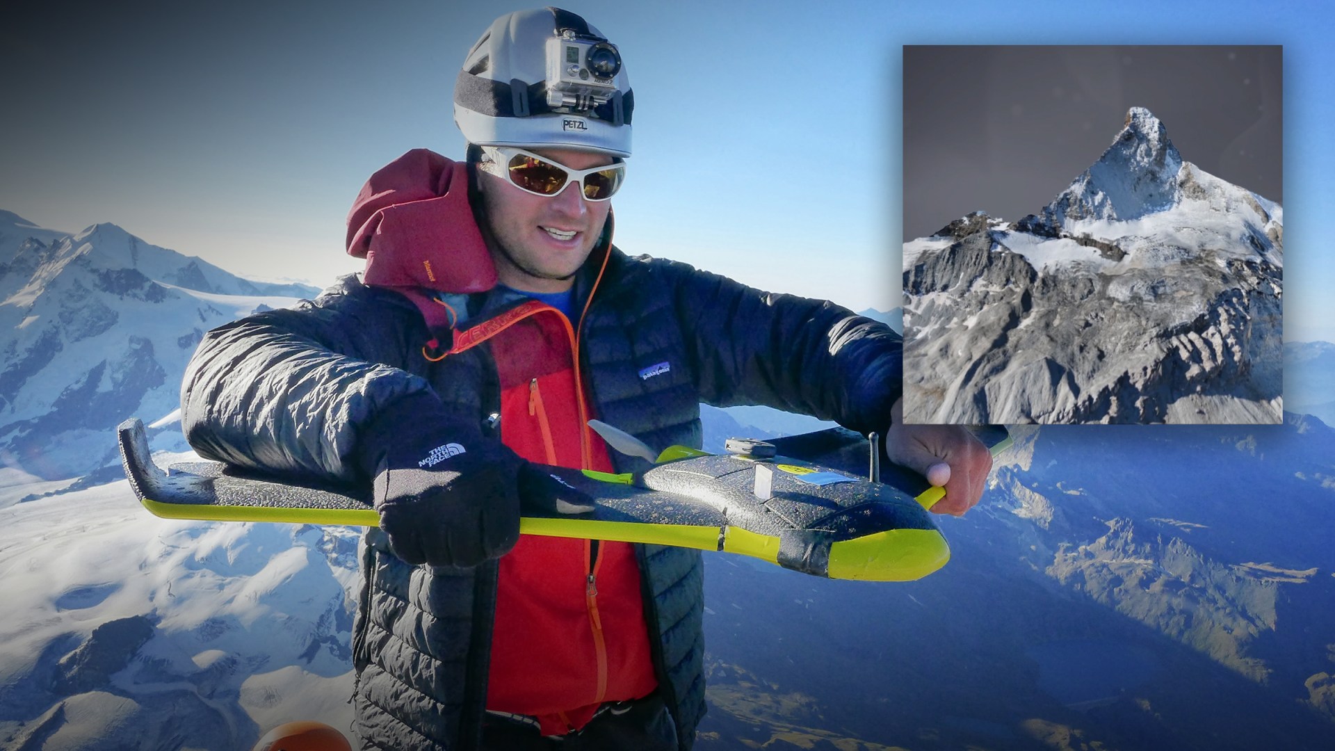
Now a new technology is enabling cartographers to take a close look at the Matterhorn: a fleet of autonomous, fixed-wing drones, launched into the sky from the summit by their makers. They mapped the mountain in just six hours.
The mapping was carried out by unmanned aerial vehicle (UAV) company SenseFly and aerial photography company Pix4D. Three eBee drones were launched from the top of the mountain, flying only 100 meters from the face, capturing points just 20 centimeters (<8 in.) apart. When they reached the bottom, a second team intercepted the drones and re-launched them for further mapping.
The maps produced aren’t just any maps—they’re 3D digital maps of the topography and visual appearance of the mountain. The cameras captured 2,188 photos during 11 flights.
The UAVs are similar to the drones sold in hobby shops but are controlled remotely by algorithms and sensors that determine how close the UAV is to the rock face so that it can capture the detail of every crevice and incline.
This eBee type of drone weighs about two pounds, has a fixed wing with a span of 38 inches, and is battery powered. (Larger drones for activities like parcel delivery or agricultural use are heavier, weighing up to ten pounds, and are driven by four rotors in a quad rotor pattern.)
New technologies like survey drones have developed so quickly that it’s easy to lose track of the fact that they did not emerge “ready formed” out of their packaging. Aerial photography has a history going back 80 years and, like many technologies, was first used for military purposes. At the start of the Second World War, both England and Germany realized they lacked detailed up-to-date maps of their cities. They raced to produce technologies that could photograph details on the ground from a high altitude in order to define bomb targets like factories. This required multiple large cameras and very fast shutter speeds. Even then, the results were grainy and blurred, as this picture of London’s docklands shows.
UAV drone technology also emerged from war, as the United States and United Kingdom needed remotely guided aircraft to deliver weapons to high risk targets in recent Middle East war zones.
UAVs’ uses are now multiplying for a variety of tasks. They aid farmers in gathering weather data, deliver medical supplies in remote areas of Rwanda, hunt hurricanes, and monitor wildlife populations in rivers, savannahs, and jungles for the purpose of conservation.
Pix4D’s demonstration of drones’ ability to map the Matterhorn brought us a beautiful new way of seeing a mountain. Swords do sometimes get transformed into ploughshares, and technology can be redeemed for good. Used well, technology can help us to steward better and, ultimately, to behold better.
David Parish is a member of Chartered Institute of Logistics and Transport, and workplace associate at the London Institute of Contemporary Christianity. He wrote “Shipping the Gospel” for The Behemoth’s issue 12.


